
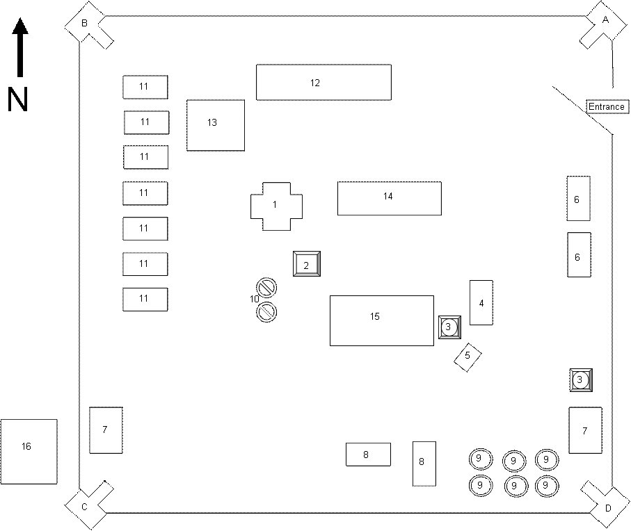
ELUNDU BASE
Sketch Map circa 1987
|
1 HQ |
2 Observation tower (`Aapkas') |
|
3 Water tower |
4 Ablution |
|
5 Power generator |
6 LWT - Tiffies |
|
7 Ammo bunkers |
8 Sappers tents - Sappers Valley |
|
9 S-tanks used to purify water |
10 Mortar pits |
|
11 Infantry tents |
12 Vehicle park |
|
13 Parade ground |
14 Mess hall and Canteen |
|
15 Stores |
16 Helli pad |
This is how I remember Elundu. I think I got most of it right, its only been 20 years, if you ever find a better or more accurate representation please pass it on to me. Somewhere close to the mortar pits I know there was a “Koffie Kroeg” and the officers tents was in that area as well. Close to the entrance there was POW cages or cells. There could have been ablutions close to the infantry tents as well.
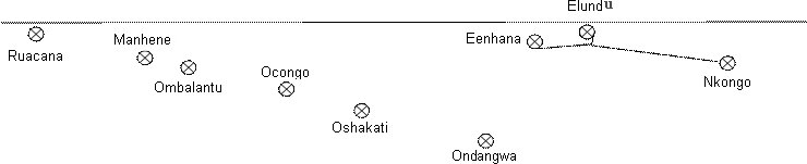
This a rough place map to show where Elundu is in relation to Enhana and Nkongo. Distances was about 28km from Eenhana and about 60 or 80km from Nkongo.
Published: 16 June 2006.
Here is a shortcut back to the
Sentinel Projects Home Page.